With my trip to Sweden rapidly approaching, I decided to go to the Ardennes once again.
Looking for an interesting hike I found plenty of inspiration at “Originele Wandelingen”
This site features about 150 different day hikes around Belgium.
Sadly the descriptions are only available in Dutch, but GPS tracks are available for most hikes.
Each hike is graded from one to five.
A while ago I found out the hard way that hikes with the highest rating are not to be underestimated.
After some consideration I picked a 16K hike called “De Oostelijke Ourthe”.
It’s rated four out of five which I think is pretty fair.
Description in Dutch
GPS Tracks
For weeks and weeks the weather has been miserable but sun is finally shining as I drive towards Filly, a small township in Houffalize.
Two hours later I arrive in the picturesque village, but can’t really find a proper place to park my car. Eventually I leave my car at a parking strip next to Rue de Houffalize.
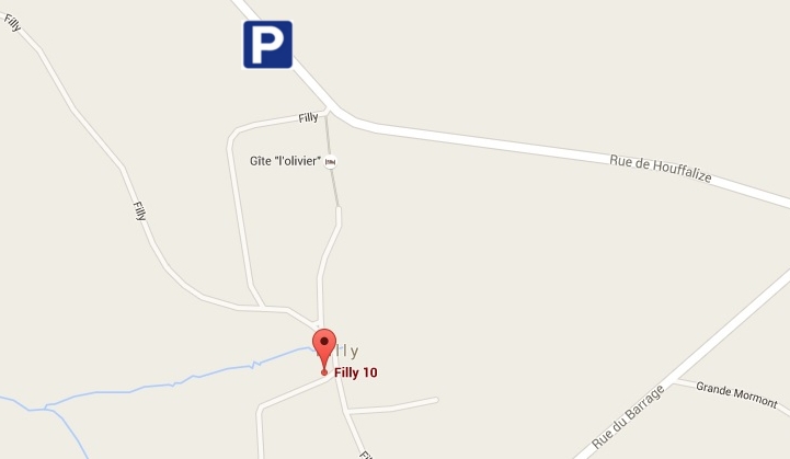
The red dot obviously indicates the starting point
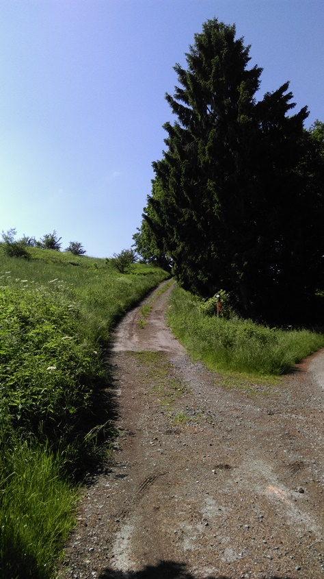
The hike starts off at the lowest point in Filly, next to a small shack and a meadow filled with sheep. Right of the bat there’s plenty of mud, so obviously you should be wearing decent boots and clothes that you don’t mind getting dirty.
After walking along meadows for a bit there’s a first short but tough climb.
Briefly you walk on a bit of a plateau surrounded by meadows.
You can also spot some beautiful poppies here.
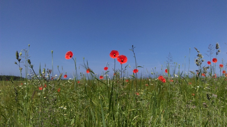
Not only in Flanders fields!
Pretty quickly a steep descent towards the river is a first test for my knees.
On and off I have been dealing with sore knees. I’m likely suffering from Plica syndrome.
A couple days of rest and lots of ice has usually done the trick, but sometimes you just have to ignore the pain 🙂
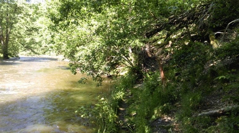
When you get to the river the trail starts to become a bit adventurous.
The massive rainfall from previous days obviously still had it’s impact and the path is very narrow at times. Frequently you also have to make your way around, over or under dead trees.
After about one kilometre along the river you reach a small bridge and you have to get to the other side. Now you follow the river upstream.
Once again the path is filled with quite some obstacles.
At times the trail is further away from the river and in general I found the hike to be very varied.
At waypoint 82 there is a highly recommended spot for taking a break.
Over here there is a pretty large wooden picnic table, but more importantly there’s a cliff which offers an amazing view. I really enjoyed my cold pasta meal here!
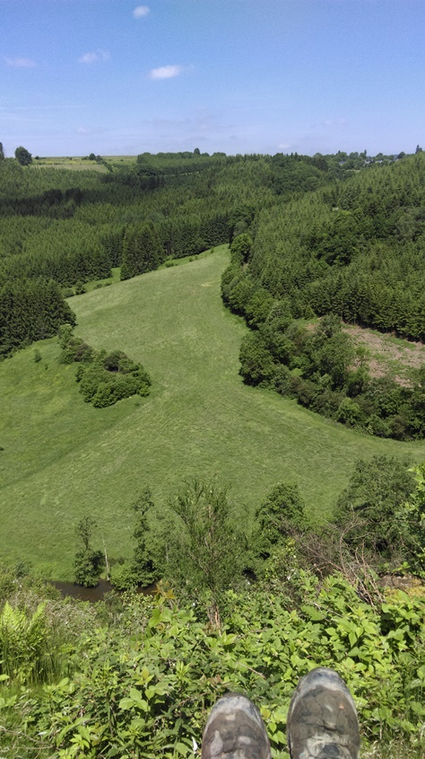
Nice view for lunch!
When you get going again it’s pretty steep downhill towards the bungalow park “Camping Rensiwez“. A bit further ahead you have to walk on tarmac for a few 100 metres.
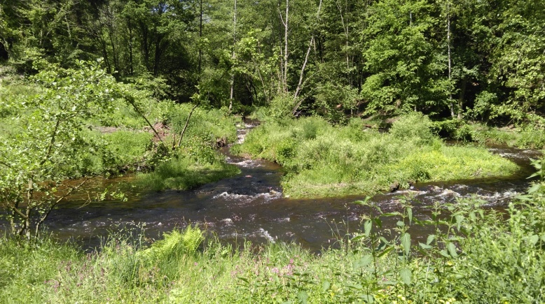
When you head into the forest again, you walk alongside a beautiful stream called “Ruisseau de Martin Moulin“. This part was really muddy. I also spotted some fishermen here.
At a certain point another stream “Ruisseau de Belle Meuse” flows into the Martin Moulin stream. At this point you just keep on going straight ahead.
After about another kilometre you have to cross the stream.
At the designated point there is a really crappy “bridge”.
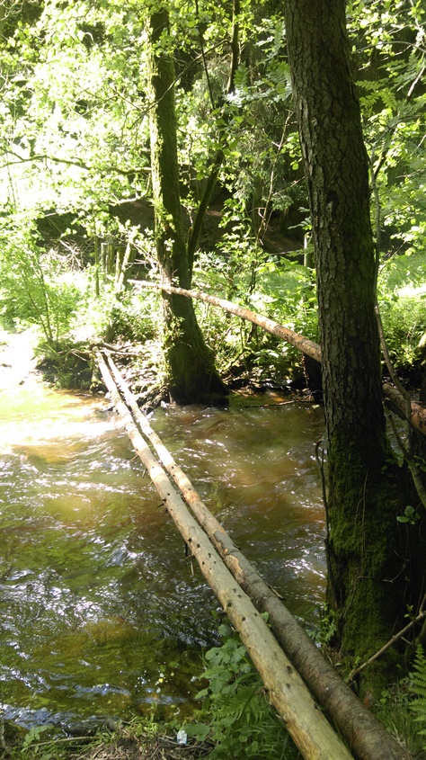 But a couple 100 metres earlier there is a very decent one.
Alternatively you can also choose to keep on following the stream for another 500 metres or so and then you will reach “Achouffe“, a small village famous for it’s beer called “La Chouffe“.

Like to taste a local beer? It’s only a 1K detour!
I opted to just follow the standard route. Bearing in mind that I also have to cross a couple streams/rivers in Sweden I decided to do the same here.
Besides the water would only get up until my knees.
With my knife I sharpened a branch in order to have better stability while crossing.
Everything went fine, but I did found out that it is very easy to underestimate a river’s current…
Off course my boots and socks were soaking wet now.
I stopped to squeeze out as much moisture as I could and walked on.
Now you in fact walk back to the crossing of streams.
When you reach the crossing again, there’s a short but very tough climb.
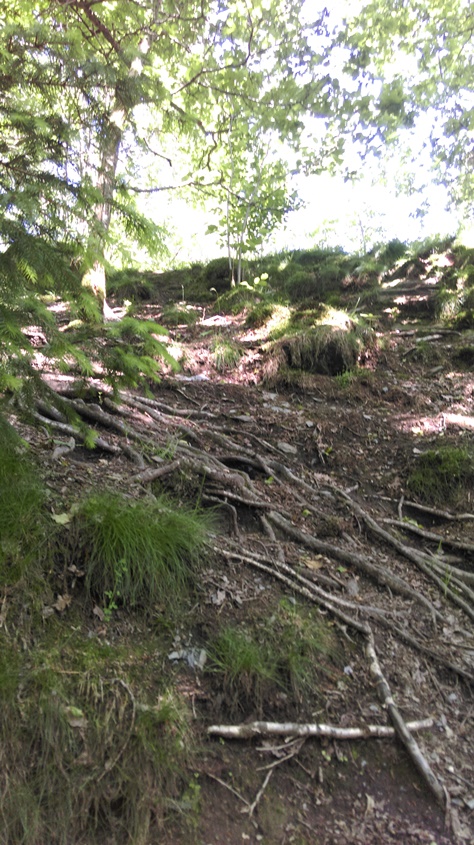
I needed a breather after this climb!
In just a few minutes you’ll be on a plateau, about 60 metres up from the stream.
At this point I took another break.
While letting my socks and boots dry out some more I enjoyed a handful of pinda nuts.
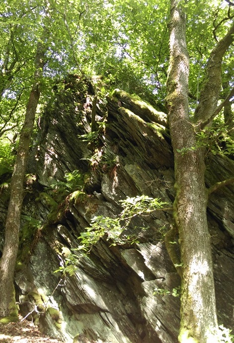
In the next part of the route the forest gets a bit more dense and you’ll also spot several interesting rock formations.
While in general the trail description is pretty good, at this point I found it to be very confusing at times. So if you are not an expert in navigation I would strongly recommend to bring along a GPS device with the tracks. Personally I have an app called GPX viewer installed on my smartphone, which you can download for free and works just perfectly.
The next few kilometres there’s still plenty of up- and downhill sections and also some very nice views. Eventually you reach a concrete bridge called “Pont de Pierre“.
Over here you have to make a right and the road now leads you up to a township called “Petite Mormont“. At this point it’s only another 2,8 kilometres until the end of the hike.
The last 100 metres you walk between two meadows and the trail is really narrow.
More importantly all the grass and the vegetation easily reaches up to about a metre and a half! So if you have a machete or something it can be useful.
Off course a branch or a walking pole can also do the trick.
The road you’ll see ahead of you now is the Rue de Houffalize.
It’s around 17.30 as I jump into my car again.
I’m not that keen on driving another 185 kilometres.
Luckily in the Ardennes region you can hit the throttle without having to worry much about speeding tickets 🙂
Back home I take a shower, eat some more pasta and… fall asleep on the couch.
My knees hurt but luckily the next day I’m not feeling any pain any more.
All in all this is a very beautiful hike and it’s also been good preparation for my trip to Sweden.
Have any questions about this hike? Feel free to ask!
